Navigation Check
It was seven in the morning when I made my way across the street to the college. The sun had been out since five but the day was dark. Clouds covered the sky as far as the horizon. I cursed myself for the luck and hoped that the cloud base was high enough for me to go ahead for my nav check. As soon as I got to Operations, I printed out a forecast. With a sigh of relief I saw that the clouds were at three thousand feet. Just enough for me to squeeze by the hills of the Darling Range. If it happened to be slightly less than that, the flight would be cancelled.
I quickly finished my flight plan. I'll be flying at three thousand all the way. Even into controlled airspace. This sortie would be interesting as I had to fly over Perth Airport and Perth City. With calculations, charts, and flight plan in hand, I went to my instructor and explained the conditions. My instructor, H, looked at the cloudbase and walked out to look at the sky. With a grim look and reminder that if the clouds got any lower we would turn back, he sent me off to prepare the aircraft. Pressure was on my instructor as the airfield we're headed to would have the chief flight instructor, a senior instructor, and my previous instructor doing airwork around the time we should be there. Since I'm the only one going for visual flying, if the conditions wasn't good for visual and we were there, the chief would have his head.
As we were flying through the Darling Range, I had to keep the plane at two thousand nine hundred feet. The clouds were just around three thousand. The great thing with clouds is that the day wasn't hot. The bad thing is that the whole flight was bumpy. To make matters worse, it started to drizzle. Visual was still good, so we pressed on. As soon as I made my inbound call for Cunnerdin, I heard two other company aircrafts radio in at five thousand and seven thousand feet each.
"Ok, can you see where the airfield is?"
Airfields are hard to spot from such a low altitude. I scanned everywhere to look for a flat piece of land. Unfortunately, everywhere is flat! Then I saw it, the cross shaped runways that I was looking for. Exactly in front of me! Quite a mean feat for visual navigation.
"Good, good, now let's do one touch and go and go off before the others get here"
So we quickly landed and took off and departed the airfield with calls from the other planes that they were now decending on to the airfield.
On our way back we went into controlled airspace. It's a cool feeling to go into controlled airspace. Everything is taken care of. I just had to fly what ever instructions they gave me. I got to see a jet take off from Perth International beneath me. I got to see the skyline of Perth. The blue ocean was right in front of me. By this time the clouds were gone and the view was spectacular. That was the first time I flew over Perth. I wish I had brought my camera with me.
As we came back, my instructor commented on how safe the flight was. I think he must have written down safe at least nine times in the report. My radio work could've been better though. I'm still giving unnecessary information. Rather than saying "Estimated time of arrival three four" I should just say "time three four" among other things. Ah well, always learning. With that, he signed my "Clear for Solo Navigation" column in my Student Solo Checklist Card.
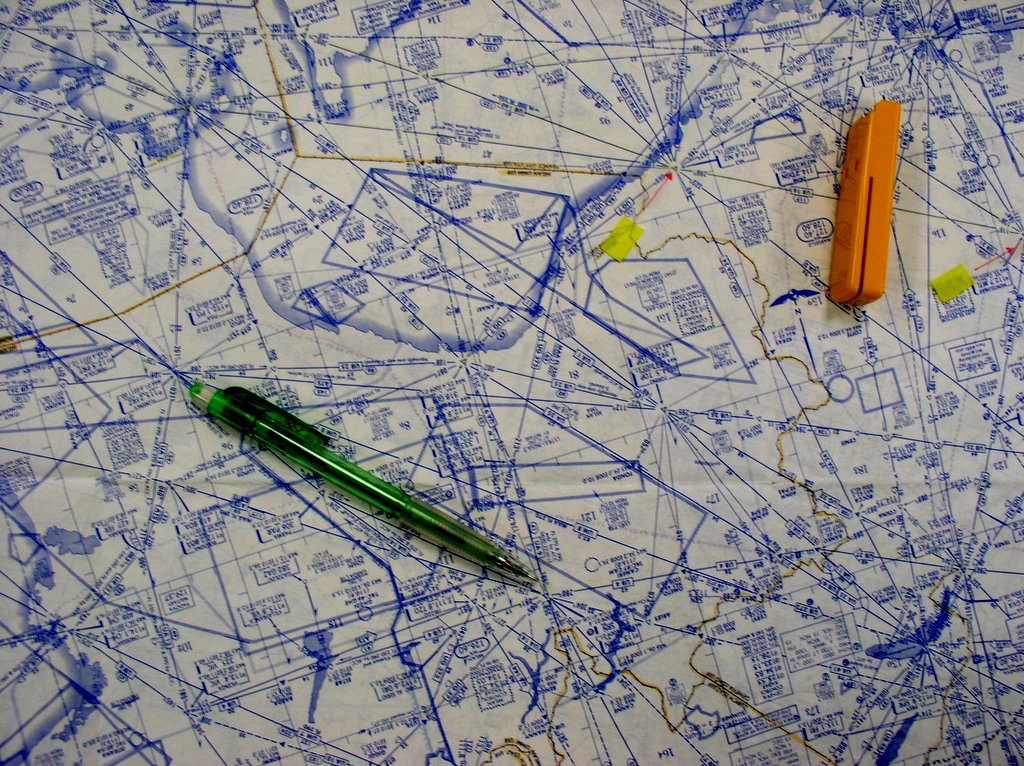
Airways Chart. What the big guys use. Not for Visual Flying.
All those lines are airways. This is why pilots need good eyesight!
I think I almost went blind reading this thing for my flight planning exam.

I quickly finished my flight plan. I'll be flying at three thousand all the way. Even into controlled airspace. This sortie would be interesting as I had to fly over Perth Airport and Perth City. With calculations, charts, and flight plan in hand, I went to my instructor and explained the conditions. My instructor, H, looked at the cloudbase and walked out to look at the sky. With a grim look and reminder that if the clouds got any lower we would turn back, he sent me off to prepare the aircraft. Pressure was on my instructor as the airfield we're headed to would have the chief flight instructor, a senior instructor, and my previous instructor doing airwork around the time we should be there. Since I'm the only one going for visual flying, if the conditions wasn't good for visual and we were there, the chief would have his head.
As we were flying through the Darling Range, I had to keep the plane at two thousand nine hundred feet. The clouds were just around three thousand. The great thing with clouds is that the day wasn't hot. The bad thing is that the whole flight was bumpy. To make matters worse, it started to drizzle. Visual was still good, so we pressed on. As soon as I made my inbound call for Cunnerdin, I heard two other company aircrafts radio in at five thousand and seven thousand feet each.
"Ok, can you see where the airfield is?"
Airfields are hard to spot from such a low altitude. I scanned everywhere to look for a flat piece of land. Unfortunately, everywhere is flat! Then I saw it, the cross shaped runways that I was looking for. Exactly in front of me! Quite a mean feat for visual navigation.
"Good, good, now let's do one touch and go and go off before the others get here"
So we quickly landed and took off and departed the airfield with calls from the other planes that they were now decending on to the airfield.
On our way back we went into controlled airspace. It's a cool feeling to go into controlled airspace. Everything is taken care of. I just had to fly what ever instructions they gave me. I got to see a jet take off from Perth International beneath me. I got to see the skyline of Perth. The blue ocean was right in front of me. By this time the clouds were gone and the view was spectacular. That was the first time I flew over Perth. I wish I had brought my camera with me.
As we came back, my instructor commented on how safe the flight was. I think he must have written down safe at least nine times in the report. My radio work could've been better though. I'm still giving unnecessary information. Rather than saying "Estimated time of arrival three four" I should just say "time three four" among other things. Ah well, always learning. With that, he signed my "Clear for Solo Navigation" column in my Student Solo Checklist Card.
 |
All those lines are airways. This is why pilots need good eyesight!
I think I almost went blind reading this thing for my flight planning exam.